Precision Aerial Surveys, Photography & Videography in Durango
Strategic Aerial Perspective for Colorado
For comprehensive aerial survey requirements throughout Colorado, including precise magnetometer and electromagnetic surveys, LiDAR data acquisition, and advanced GIS mapping, Durango Helicopter Charters offers a versatile suite of solutions. Leveraging the unparalleled low-altitude flight and stable hover capabilities inherent to helicopters, we ensure the capture of highly accurate geospatial data critical for infrastructure planning, resource management, and geological assessments across the Four Corners region. Furthermore, our specialized aerial filming services provide access to cutting-edge cinematography and photography platforms, with options ranging from sophisticated gyro-stabilized camera systems to aircraft configured for door-off handheld operations. This comprehensive approach ensures optimal data and visual capture, precisely aligning with your project's technical specifications.
Aerial
Surveys
LiDAR, GIS Maps, FLIR, HD Video & More
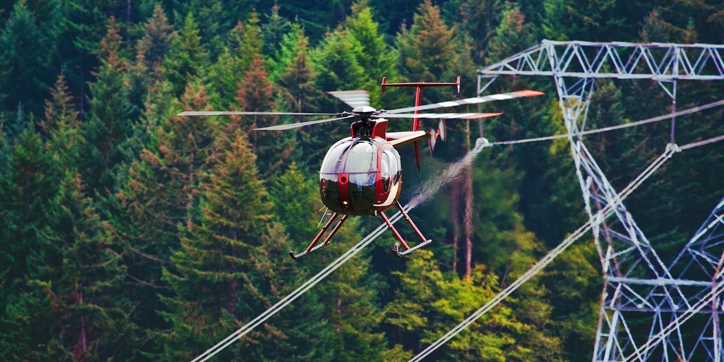
For pipeline inspections, right-of-way (ROW) assessments, and transmission line patrols, Durango Helicopter Charters delivers precise aerial solutions. We ensure access to aircraft equipped with specialized instrumentation, facilitating thorough and efficient data acquisition for your critical infrastructure projects across Colorado.
High Tech Results
The Top Pilots in Colorado, Today's Technology... Maximum Results.
Call 1-866-826-4826 Now!
Durango Helicopter Charters provides the tools needed to complete your land surveys, utilizing the right equipment to provide the aerial photos that are often needed.
Effective aerial surveys streamline complex right-of-way (ROW) and site inspections, accelerate topographical data collection, and provide high-definition visual documentation essential for commercial projects across Colorado. Helicopters offer the optimal platform for surveying challenging terrain, precisely identifying pipeline integrity issues, detecting anomalies within transmission line networks, and capturing critical video and photographic evidence of assets. Durango Helicopter Charters specializes in developing bespoke photographic and remote sensing operations. These solutions are meticulously customized to maximize both technical efficacy and financial efficiency, ensuring superior results that directly contribute to your project’s success and informed decision-making.
The inherent operational versatility of helicopters makes them the premier platform for high-precision aerial surveying. Unlike fixed-wing aircraft, which are subject to FAA minimum altitude requirements typically at 1,000 feet above the highest obstacle, helicopters can execute stable, low-altitude flight profiles and sustained hover capabilities. This unique flexibility enables unparalleled access to challenging or hazardous terrains, offering engineers and field teams a direct, granular perspective otherwise unattainable. Such precise maneuverability ensures superior data resolution and comprehensive inspection of critical assets, proving indispensable for detailed analyses across the varied landscapes of Colorado.
There is no better way to conduct your visual survey, animal population counts, soil drainage analysis, ROW inspections, pipeline and transmission line inspections, and geographical surveys.

LiDAR Imaging
Light Detection and Ranging, or LiDAR, is a remote sensing method used to examine and measure Colorado topography as well as objects, like vegetation, upon it.

Infrared Imaging
Thermographic IR cameras are used to detect radiation in the long-infrared range of the electromagnetic spectrum and produce images of that radiation, called thermograms.
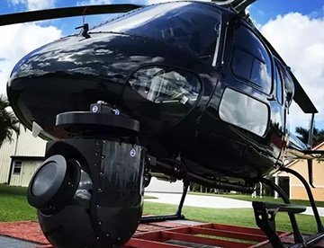
HD Video Gimbal Capture
Modern HD and 4K cameras can be mounted to helicopters, using the proper STCs, with a gimbal to stabilize photos & videos for detailed results.

Advanced Aerial Filming for Professional Productions
For expert camera work in the Durango Sky
Get a Fast, free QuoteDurango Aerial Cinematography
Durango Helicopter Charters provides unparalleled access to professional-grade aerial cinematography capabilities throughout Colorado. We facilitate custom shoots utilizing the industry's most advanced gyro-stabilized camera mounts, including Tyler Mounts, Wesscam, Cineflex, Pictorvision, and SpaceCam, seamlessly integrated with specialty cameras such as Cineflex HD, RED Epic, Arri Alexa, alongside 3D and experimental camera systems. Whether your production requires dynamic air-to-air sequences or precise ground-to-air perspectives, we support every facet of your visual objectives. Our operational expertise ensures exceptional cinematography, working closely with your aerial Directors of Photography and production teams to achieve the exact visual narrative you envision. Specializing in helicopter support for both still and motion photography, Durango Helicopter Charters is equipped to facilitate a broad spectrum of media-related operations across Colorado, from feature films, television productions, and documentaries to promotional videos, commercials, and aerial prop deployments. Furthermore, we provide essential aerial support for television network relief coverage and comprehensive visual documentation of historical events and major sporting spectacles, utilizing a diverse fleet configured for optimal performance. This comprehensive service ensures your production benefits from cutting-edge technology and precision aerial execution, delivering superior visual content.
Call Us Today at 1-866-826-4826 for a Free Quote
Contact Us
Aerial Photos
Hand-held or Mounted OpTions in Durango
We will help you get the right equipment for your aerial photography project! Call 1-866-826-4826 today to get a fast, free quote.
The Most Options for Photography
Capturing the iconic landscapes and distinctive geological features of Colorado with unparalleled clarity and perspective is best achieved from an aerial platform. Durango Helicopter Charters provides specialized aerial photography charters meticulously designed to translate your precise creative vision into stunning visual assets. We facilitate the capture of high-resolution imagery across locations from the San Juan Mountains to the vast eastern plains, ensuring your photographic objectives are not merely met, but surpassed. Committed to offering cost-effective solutions, we provide access to aircraft configured for a range of photographic needs. Options include helicopters with removable doors for dynamic handheld projects, alongside advanced gyro-stabilized camera mounts for enhanced stability and precision, crucial for achieving professional-grade results. This comprehensive approach empowers photographers and visual artists to produce exceptional work.
Superior Service
Every one of our customers gets a dedicated helicopter expert to assist with flight plans, tech loadouts, production logistics, project schedules, and other demands.
Over 500 Aircraft
Our network of direct air partners extends well beyond Durango, Colorado. This allows us to offer a wide range of solutions for even the most sophisticated projects.
The Best Equipment
From high-tech sensors like LiDAR, FLIR, and GIS to HD cameras and movie production gimbals, we're here to make your job as easy as possible.